Construction has always been a race against time, cost, and uncertainty. Delays, budget overruns, and unforeseen site conditions can derail even the most meticulously planned projects. But today, technology is reshaping how we build, offering new ways to monitor progress, assess risks, and plan with precision. Satellite imagery, once reserved for scientific research and defense, is now becoming an essential tool in construction, providing a level of oversight that was unimaginable just a decade ago.
From tracking large-scale infrastructure projects to analyzing terrain before breaking ground, satellite data offers a unique advantage. With the ability to view and analyse real-time satellite images, construction teams can gain insights on the fly, monitor changes over time, and even anticipate potential disruptions.
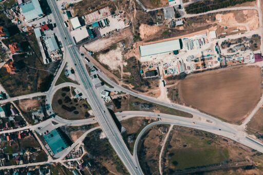
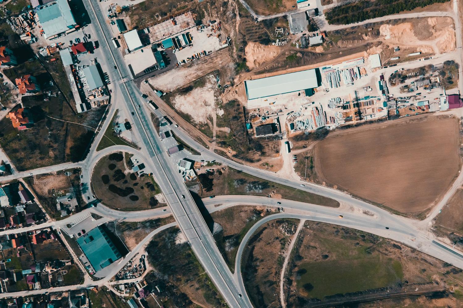
Monitoring Construction Sites with Satellite Imagery
Traditional on-site inspections are time-consuming and often provide only a fragmented perspective of a project’s status. Latest satellite imagery eliminates these gaps by delivering high-resolution, regularly updated visuals of construction sites. Engineers and project managers can compare snapshots taken days or even hours apart, tracking incremental changes in building structures, road networks, and site development. By overlaying these images with planned construction timelines, discrepancies between expected and actual progress become immediately evident, allowing teams to make data-driven decisions to stay on schedule.
Beyond tracking overall progress, satellite data also reveals critical structural modifications. Advanced imaging techniques, such as synthetic aperture radar (SAR) and high-resolution optical sensors, can highlight deviations in building dimensions, ground displacement, and even potential safety hazards. For large-scale infrastructure projects, such as bridges, highways, or high-rise developments, satellite monitoring helps identify early warning signs of structural stress, preventing costly and dangerous failures before they occur.
Governments and regulatory bodies increasingly rely on satellite imagery to enforce compliance with zoning laws, environmental regulations, and urban development plans. Developers can use the same technology to ensure their projects align with approved designs and legal requirements, mitigating the risk of fines or delays. Frequent satellite updates provide an unbiased, third-party record of a project’s adherence to timelines, offering a layer of transparency that benefits all stakeholders, from investors to local communities.
By integrating satellite imagery into construction management, the industry moves toward a future where project oversight is more efficient, precise, and proactive. As satellite technology continues to evolve, construction firms will gain even greater access to real-time insights, transforming how large-scale projects are monitored and managed.

Analyzing Land and Environmental Factors Before Construction
Selecting the right location is one of the most critical decisions in any construction project. A poorly chosen site can lead to unexpected costs, structural risks, and environmental complications. Latest satellite imagery maps, combined with advanced data analytics, empowers developers to make informed decisions by offering a comprehensive assessment of land suitability before any groundwork begins.
Analyzing Soil Conditions and Topography
Soil stability is a foundational factor in construction. Weak or shifting soil can compromise structural integrity, leading to costly reinforcements or long-term damage. Satellite sensors, particularly those equipped with infrared and multispectral imaging, assess soil composition, moisture levels, and compaction. These insights allow engineers to determine whether a site can support large structures or if additional ground stabilization measures are required.
Topography plays an equally important role. High-resolution elevation models derived from satellite data provide a detailed understanding of terrain variations, helping planners optimize building placement, road networks, and drainage systems. This level of precision minimizes the risk of costly design revisions and ensures efficient land use.
Mitigating Environmental Hazards
Natural hazards like flooding, erosion, and land instability can significantly impact construction projects, but satellite imagery helps developers anticipate and address these risks before they become costly problems.
By analyzing historical flood patterns and water flow dynamics, satellite data identifies areas prone to flooding, enabling engineers to design better drainage systems or reconsider site selection. It also detects vegetation loss and soil composition changes, highlighting regions vulnerable to erosion and informing stabilization strategies. Advanced radar technology further assesses land stability by tracking subtle ground shifts, providing early warnings of potential subsidence or landslides. With these insights, construction teams can build on safer, more resilient foundations while minimizing environmental disruption.
Forecasting Risks and Optimizing Resource Management
Satellite imagery plays a crucial role in forecasting construction risks, from extreme weather events to shifting geological conditions and rapid urban expansion. By analyzing climate patterns, it helps predict extreme weather events such as storms, heatwaves, and heavy rainfall, allowing developers to adapt schedules and reinforce structures before adverse conditions strike. Geological monitoring through satellite radar can detect subtle land shifts, indicating risks of subsidence, landslides, or seismic activity, ensuring that projects avoid unstable ground. In rapidly expanding urban areas, satellite data also tracks infrastructure growth and zoning changes, helping developers navigate evolving cityscapes and regulatory constraints.
Beyond risk mitigation, satellite intelligence optimizes material use and enhances supply chain logistics. By monitoring transportation routes, tracking shipments, and assessing real-time site conditions, it prevents costly delays and resource shortages. Developers can adjust procurement schedules based on up-to-date insights, reducing waste and ensuring materials arrive precisely when needed. As construction projects grow more complex, integrating satellite-driven decision-making makes them not only safer but also more efficient and sustainable.
By providing real-time insights into site conditions, tracking structural progress, and forecasting potential risks, satellite data enhances decision-making at every stage of construction. Whether optimizing land selection, mitigating environmental hazards, or streamlining logistics, this technology helps developers reduce costs, improve efficiency, and minimize unexpected challenges. As the construction industry continues to evolve, embracing satellite-driven intelligence based on latest satellite images of Earth will be key to ensuring sustainable, resilient, and future-ready infrastructure.